Where is Japan?
Key terms
Many maps of Japan place it in isolation, such as this map from the Lonely Planet web page:
|
Japan seems to be floating in the middle of the sea: the Korean peninsula is largely obscured by an inset showing the Ryukyu Islands and Okinawa. In this way, the archipelago that connects Japan to Taiwan, is moved, and used to obscure Japan's closeness to the Korean peninsula. The island of Sakhalin is completely missing. |
Japanese maps from the 17th century are often similar. This map ignores Hokkaidō and shows only fragments of the Korean peninsula, dropping in from the top. This vision of Japan reflects restrictions on travel, which keep most Japanese from leaving the main islands. For a better image see the Kyūshū University Museum |
 |
 |
This map of Japan shows it at the far edge of East Asia, but connections to Russia are less clear. Notice how Japan seems to float at the edge of East Asia. |
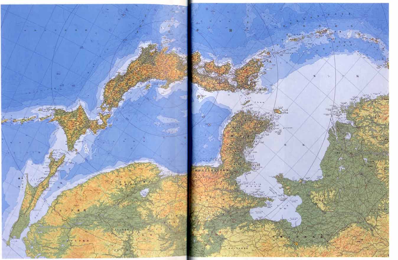 |
Contrast this with a famous map by Amino Yoshihiko, which emphasizes Japan's connections with the continent. Sakhalin clearly connects Japan to Siberia, and the Ryukyu islands almost touch the Chinese mainland. Amino entitled this map "The Sea of Japan is a Mediterranean" () to dramatize this aspect of Japanese geography.
Amino Yoshihiko. 2000. "Nihon" to wa nani ka, Nihon no rekishi 01. Tokyo: Kōdansha. |
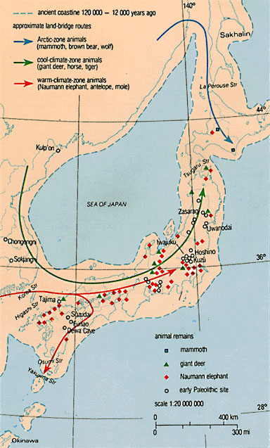
Non-seafaring animals (human or otherwise) reached the Japanese islands through land bridges during the Ice Age. Note that there were multiple overland paths to Japan.
Collcutt, Martin, Marius B. Jansen, and Isao Kumakura. 1988. Cultural Atlas of Japan. New York: Facts on File. |
 |
 |
|
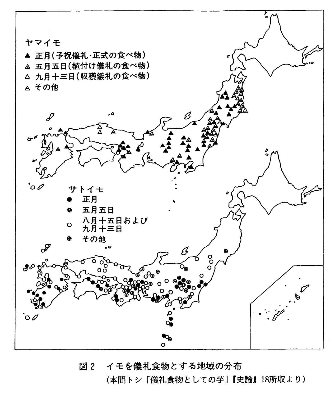
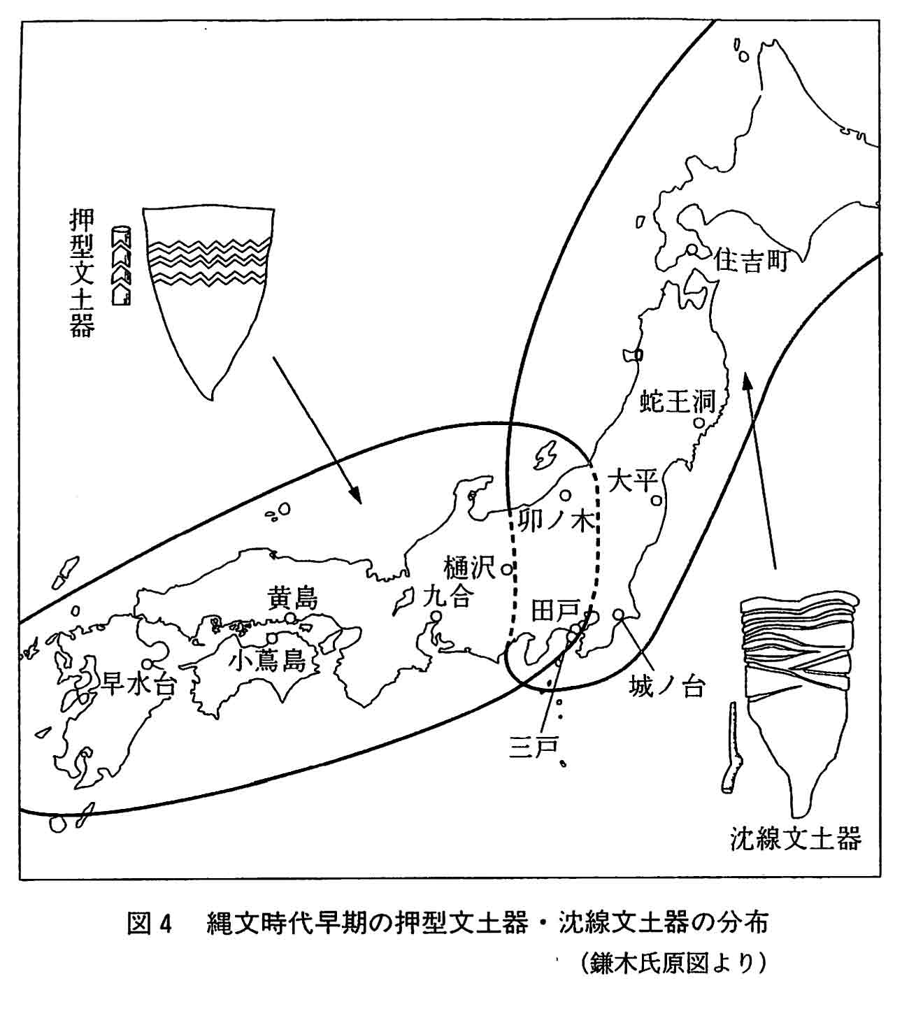
| Note that these different pathways to Japan had a lasting impact on Japanese culture. We can see an east-west divide, for example, in pottery styles from the Neolithic (before 300 BCE). | An east-west divide is still visible today in language and folk custom. In this map, the traingles represents places where yams are called "yamaimo" while the circes are places where yams are called "satoimo." What other historical factors created this east-west divide? Amino Yoshihiko. 1998. Higashi to nishi no kataru Nihon no rekishi. Tokyo: Kōdansha. |
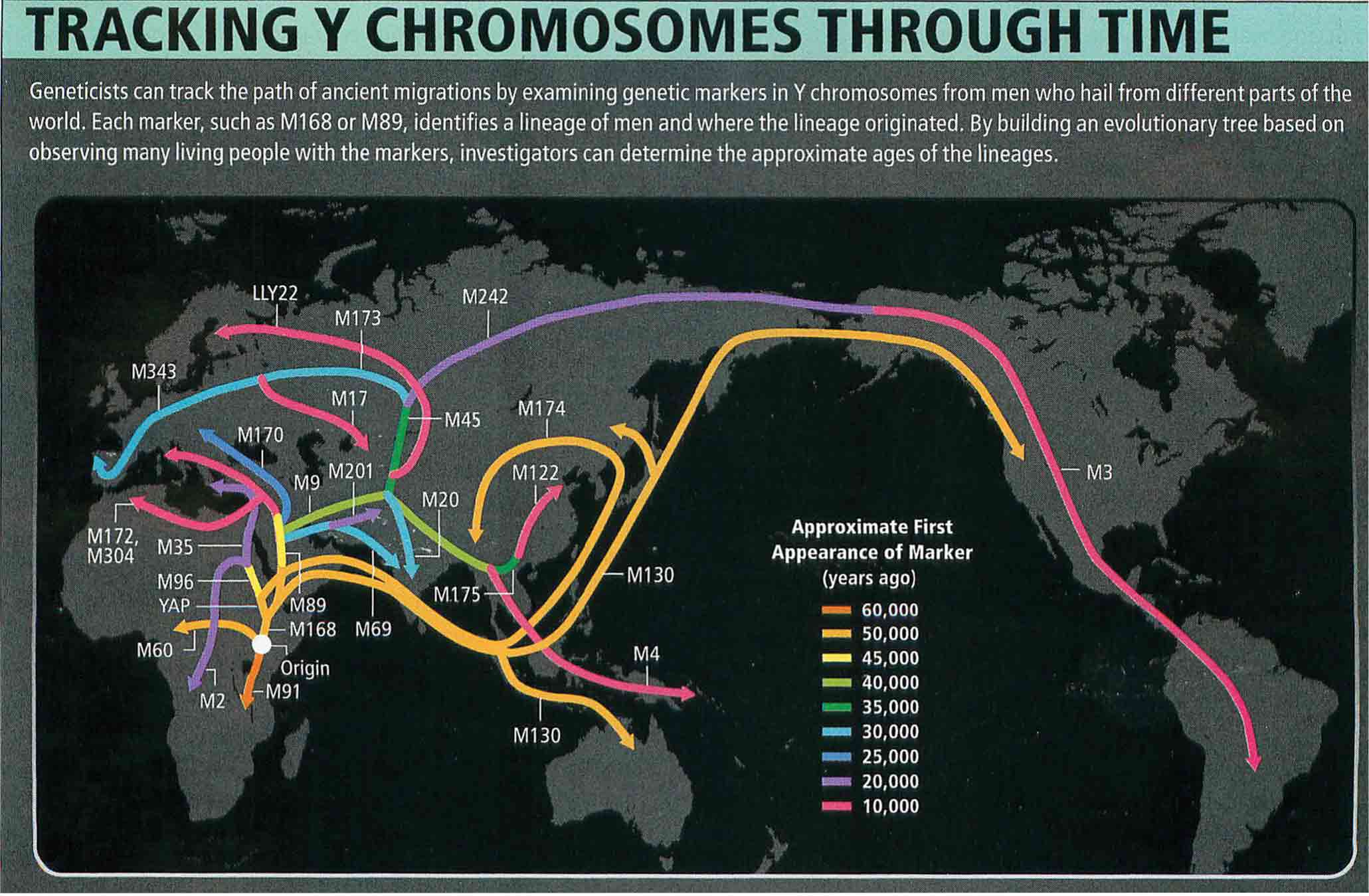 |
Japan's connections to maritime Asia can be seen in biomedical analysis. Humans arrived on the Japanese islands from Southeast Asia some 50,000 years ago. This data is particularly important given recent scandals in Japanese archaeology.
Stix, Gary. 2008. Traces of a Distant Past. Scientific American, July, 56-63. |
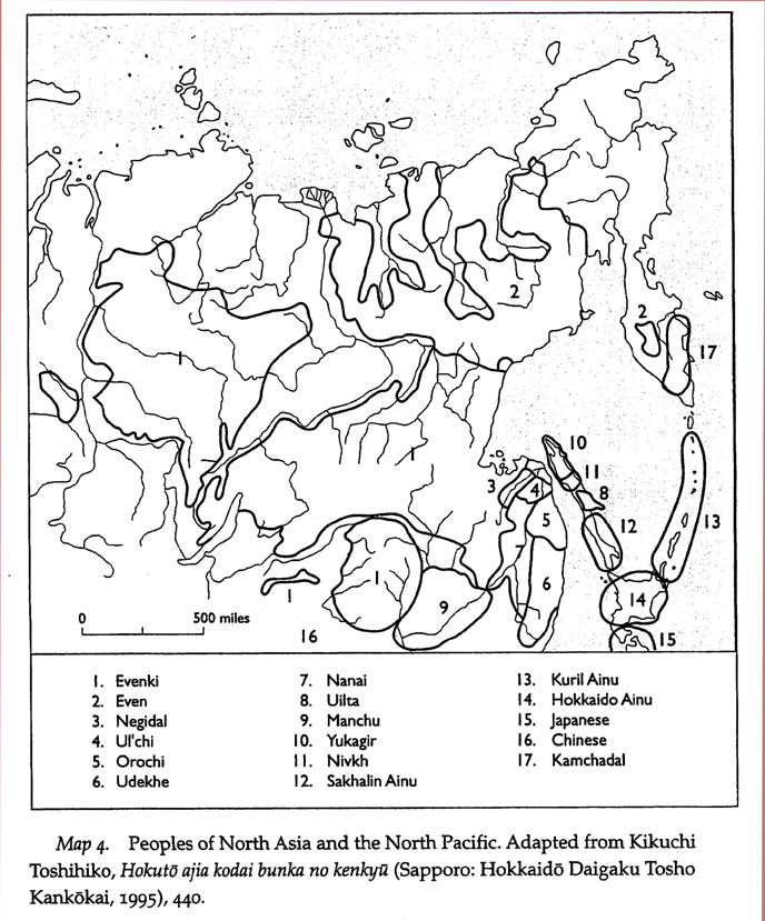 |
We can also rethink Japan's place in the world by placing it at the periphery of other places. This map, for example, puts Japan, China, and Russia at the edge of the Northeast Asia world of the Evenki, the Even, and the Ainu. Why do we see maps like this so rarely? Walker, Brett L. 2001. The Conquest of Ainu lands: Ecology and Culture in Japanese Expansion, 1590-1800. Berkeley: University of California Press. |